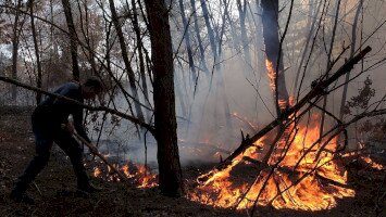
Újabb nemzetközi együttműködés erősíti Közép-Európa geoparkjainak kapcsolatát: testvérgeoparki megállapodást kötött a Bükk-vidék UNESCO Globális Geopark és a Karavankák UNESCO Globális Geopark. Az együttműködési szerződés aláírására március 23-án az Európai Geoparkok Hálózatának (EGN) 53. Koordinációs Bizottsági Ülés nyitóestéjén került sor, amely a kontinens geoparkjainak egyik legfontosabb szakmai fóruma.

A testvérgeoparki együttműködést Rónai Kálmánné, a Bükki Nemzeti Park Igazgatóság igazgatója, a Bükk-vidék UNESCO Globális Geopark munkaszervezetének igazgatója, és Gerald Hartmann, a Karavankák (Karawanken-Karavanke) UNESCO Globális Geopark igazgatója írta alá.
A megállapodás célja, hogy a két geopark szorosabb szakmai és turisztikai együttműködést alakítson ki, különös tekintettel a földtudományi örökség megőrzésére, a fenntartható turizmus fejlesztésére és a környezeti nevelés erősítésére. A felek hangsúlyozták: a geoparkok szerepe ma már túlmutat a természeti értékek bemutatásán, hiszen aktívan hozzájárulnak a helyi közösségek gazdasági és kulturális fejlődéséhez is.
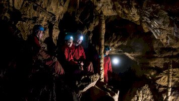
A Bükk-vidék Geopark Magyarország egyik kiemelkedő földtani értékekben gazdag térsége, amely a Bükk hegység változatos karsztformáiról, barlangjairól és gazdag élővilágáról ismert. A Karavankák Geopark – amely Szlovénia és Ausztria határvidékén helyezkedik el – szintén különleges geológiai képződményekkel és határon átnyúló együttműködési modellel rendelkezik, így ideális partner a tudásmegosztás és közös projektek szempontjából. A cél, hogy a két geopark egymás jó gyakorlataiból tanulva még hatékonyabban tudja bemutatni természeti örökségét mind a látogatók, mind a helyi lakosság körében.
Az EGN találkozó ideális helyszínt biztosított az együttműködés formalizálására, hiszen itt Európa geoparkjai közösen dolgoznak azon, hogy egységes szakmai irányelvek mentén fejlesszék tevékenységüket. A most megkötött megállapodás jól példázza, hogy a nemzetközi kapcsolatok kulcsszerepet játszanak a geoparkok hosszú távú sikerében.
A felek bizakodóak: a testvérgeoparki együttműködés nemcsak szakmai szinten hozhat előrelépést, hanem hozzájárulhat a térségek nemzetközi láthatóságának növeléséhez és a látogatószám bővítéséhez is.
Képek: Urosh Grabner
Twinning Agreement Signed Between the Bükk Region and the Karawanken-Karavanke Geoparks
A new international partnership is strengthening the cooperation among Central Europe’s geoparks: a twinning agreement has been signed between the Bükk Region UNESCO Global Geopark and the Karawanken-Karavanke UNESCO Global Geopark. The agreement was signed on 23 March during the opening evening of the 53rd Coordination Committee Meeting of the European Geoparks Network (EGN), one of the most important professional forums for geoparks across the continent.

The twinning agreement was signed by Mrs. Kálmánné Rónai, Director of the Bükk National Park Directorate and head of the Bükk Region UNESCO Global Geopark organisation, and by Gerald Hartmann, Director of the Karawanken-Karavanke UNESCO Global Geopark.
The aim of the agreement is to establish closer professional and tourism cooperation between the two geoparks, with a particular focus on the preservation of geological heritage, the development of sustainable tourism, and the strengthening of environmental education. The partners emphasized that the role of geoparks today goes beyond the presentation of natural values, as they actively contribute to the economic and cultural development of local communities.
The Bükk Region Geopark is one of Hungary’s most outstanding areas rich in geological heritage, known for the diverse karst formations, caves, and rich biodiversity of the Bükk Mountains. The Karawanken-Karavanke Geopark, located along the border between Slovenia and Austria, is also characterized by unique geological formations and a strong cross-border cooperation model, making it an ideal partner for knowledge exchange and joint projects. The goal is for both geoparks to learn from each other’s best practices and to present their natural heritage even more effectively to visitors and local communities alike.
The EGN meeting provided an ideal platform for formalizing the cooperation, as Europe’s geoparks work together here to develop their activities along common professional guidelines. The newly signed agreement clearly demonstrates the key role of international partnerships in the long-term success of geoparks.
The partners are confident that this twinning cooperation will not only bring professional advancement but also contribute to increasing the international visibility of the regions and boosting visitor numbers.
Photos: Urosh Grabner